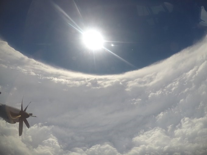
Grand Bahama Island is bearing the brunt of Hurricane Dorian, as the eye of the storm appears stationary.
The eye of the hurricane is locked on Grand Bahama Island delivering sustained winds of up to 230 km/h, the National Weather Service reports.
The storm's movement is actually considered "stationary" as the eye is barely moving.
Hurricane and storm surge warnings were issued up and down the coast extending into Georgia.
A slow westward to west-northwestward motion is expected to resume overnight and continue into early Tuesday, the Weather Service predicts. A turn toward the northwest is forecast by late Tuesday, with a northeastward motion forecast to begin by Wednesday night.
On this track, the core of extremely dangerous Hurricane Dorian will pound Grand Bahama Island into tomorrow morning (Sept. 4).
The hurricane will then move dangerously close to the Florida east coast late Tuesday through Wednesday evening and then move dangerously close to the Georgia and South Carolina coasts on Wednesday night and Thursday.
An Air Force Reserve Hurricane Hunter aircraft found maximum sustained winds are near 230 km/h with higher gusts. Dorian is a category 4 hurricane on the Saffir-Simpson Hurricane Wind Scale. Although gradual weakening is forecast, Dorian is expected to remain a powerful hurricane during the next couple of days.
Hurricane-force winds extend outward up to 75 km from the centre and tropical-storm-force winds extend outward up to 240 km.
Sustained winds of 89 km/h with a gust to 111 km/h was reported at a NOAA Coastal Marine observing site at Settlement Point on the west end of Grand Bahama Island.
If that weren't enough, isolated tornadoes are possible through Tuesday along the eastern coast of Florida.
- John K. White, Castanet


