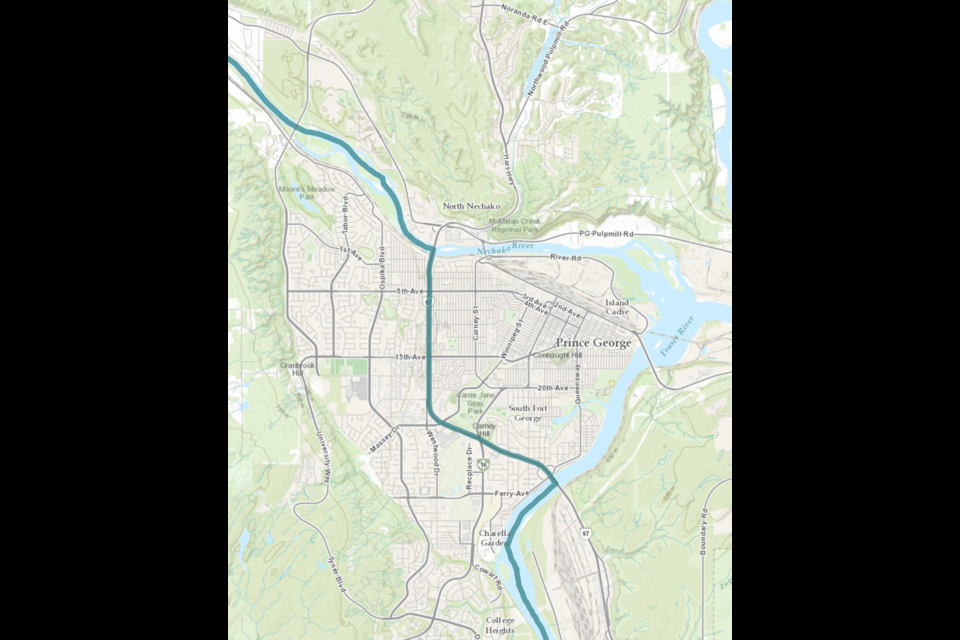
If you live east of Highway 97 between the Nechako and Fraser rivers in Prince George, there’s a good chance you’ll be voting in a different riding in the April 28 federal election.
Canada is required by law to update the boundaries of federal electoral districts, also known as ridings, every 10 years to account for population change.
Commissions were established for each province that proposed new boundaries for the ridings in each province in 2022. These commissions got feedback from residents and proposed final reports on boundary changes in February 2023.
British Columbia was one of three provinces that received extra seats in the House of Commons during this process. BC received one extra seat, Alberta received three and Ontario also received one more seat.
In this process, Cariboo-Prince George expanded to include the area around 100 Mile House while Prince George-Peace River-Northern Rockies remained mostly the same.
However, the dividing line between the two ridings within Prince George has changed.
Under the old boundaries, the border between the ridings went through the city’s core.
- Coming from west of the city, the border used to lie in the middle of the Nechako River, with Prince George-Peace River-Northern Rockies to the north and Cariboo-Prince George to the south.
- Then, at the John Hart Bridge, the border turned south with Cariboo-Prince George to the west and Prince George-Peace River-Northern Rockies going southwards with Highway 97 as the dividing line.
- Then, the border curved northeast when the highway intersected with Massey Drive, then went along Winnipeg Street until it reached 15th Avenue.
- The border then travelled eastwards along 15th and Patricia Boulevard until First Avenue. Then, the halfway along the Yellowhead Bridge, the border turned southwards along the Fraser River for a long ways until it heads east just south of Stoner.
The new boundary between the two ridings is much simpler, with Highway 97 as the dividing line.
Once the Nechako River reaches the John Hart Bridge, the border extends along Highway 97 all the way until the Simon Fraser Bridge, where it starts to follow the Fraser River southwards until that same point near Stoner.
What this means:
- If you live in Prince George north of the Nechako River, you vote in Prince George-Peace River-Northern Rockies.
- If you live in Prince George south of the Nechako and east of Highway 97 or east of the Fraser River south of the Simon Fraser Bridge, you vote in Prince George-Peace River-Northern Rockies.
- If you live in Prince George south of the Nechako and on the western side of Highway 97, you vote in Cariboo-Prince George.


