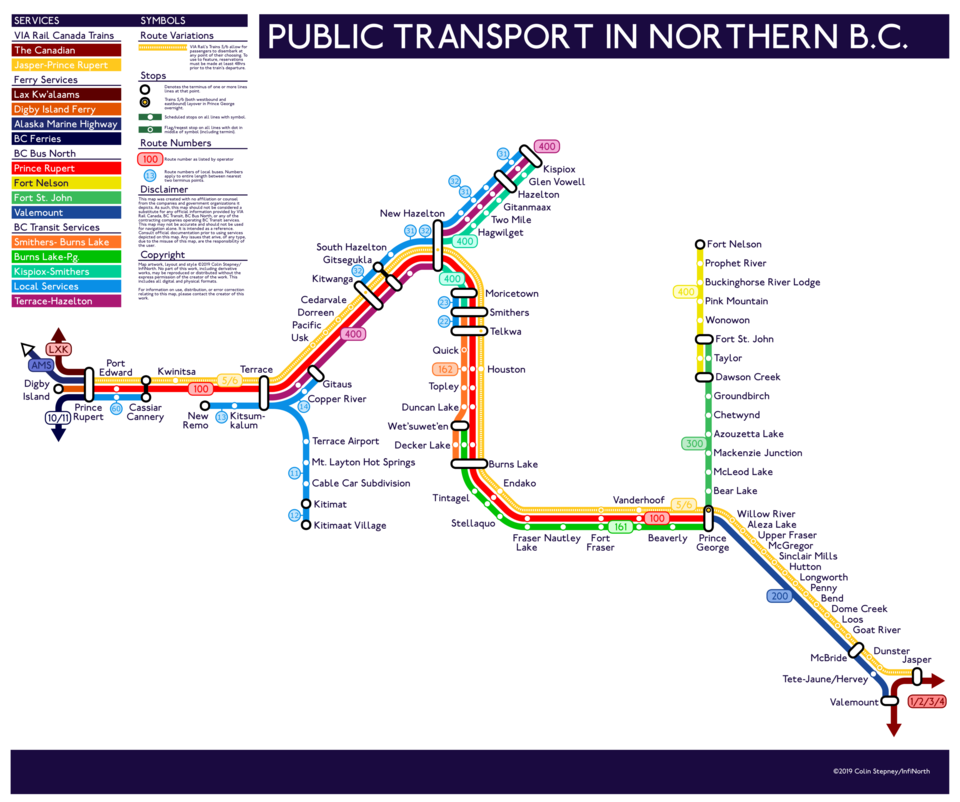
Without a car, planning a trip in northern B.C. can be an arduous journey in itself.
That’s why a University of Victoria Student, with a keen interest in mapping, has created a subway style-map of the public transportation options in the region.
This is actually Colin Stepney’s second edition of the map, as he created a first version back in September 2018.
“As a student in UVic, I’m studying elementary education and we have a big focus on rural areas and I didn’t really know anything about northern British Columbia,” Stepney tells PrinceGeorgeMatters. “I learned more about rural areas and some of the problems there are in the north associated with people not being able to get around safely, and so, I started compiling the information and decided to put it into a map form.”
Stepney researched all of the different transportation providers and created a detailed list of the destinations they served to create his map.
“This presented a challenge because I was having to represent what actually was in place and try and make it visually appealing and useful to anyone who wanted to use it.”
Since publishing the first version of his map on Reddit, Stepney said he’s received a lot of positive feedback and helpful tips from people who live in the areas he’s representing.
Nevertheless, he includes a disclaimer on his map, to let people know they should do further research if they are planning a trip using the map.
“I’m not from the area, I’m not 100 per cent familiar with the places, and so all of the information I have is only based on my research. It’s not based on my experience,” says Stepney. “It does look like there are connecting services, but a lot of those only run one day a week or two days a week meaning that you’ll have to plan out your trips very carefully if you are going to be using the transportation system.”
Stepney says not much has changed or improved in terms of actual infrastructure between the time he’s created the two versions of the maps. He also notes that he hears a lot of people expressing frustration with the system.
“It is a very small map for a huge area, and I think that is very representative of the lack of infrastructure for the people that live in northern British Columbia,” he explains. “I do have a friend at university who travels eight hours by car to get to the nearest airport and there has never been a bus service to the area they live in. This map is small and it's small because the services that are available are quite small.”
Stepney says he’s also working on a much larger mapping project, that would include transportation services for the entire province, excluding Vancouver Island.
“After greyhound left B.C. there isn’t one central place to see how to get around on the ground.”
Stepney also says he’d like to spend some more time in the north once he finished his teaching degree.


