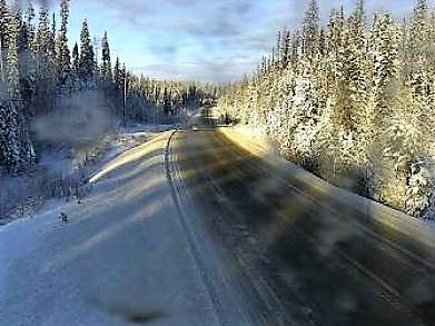
British Columbia residents now have more views of B.C. highways with multiple new web cameras being installed in 2018 including some near Prince George.
One camera was installed north of Prince George on the east side of McLeod Lake, just south of the Whiskers Point Provincial Park entrance. The government says this camera is part of the Ministry of Transportation and Infrastructure's road weather information system and looks north/south.
It fills a gap along Highway 97, north of Prince George.
Highway 27 at Hill/Greenview in Fort St. James also has a now operating camera. Government Communications and Public Engagement Media Relations Officer Lindsay Byers tells PrinceGeorgeMatters in an email that the camera actually went live in 2017 but died quickly after and didn't come back into service this year. This is not included in the new 22 but is still of note.
That camera provides north and south views of Highway 27 for those travelling through Fort St. James.
The full list of new cameras added are:
- Annis Pit — Highway 1 at Annis Pit, eight kilometres southwest of Sicamous
- Aspen Grove — Highway 97C at Highway 5A near Aspen Grove
- Blaeberry — Highway 1 near Blaeberry River Bridge, looking southeast
- Barden Road — Highway 97 near Braden Road
- Bromley Rock — Highway 3 about 1.4 kilometres east of Bromley Rock Provincial Park
- Butler — Highway 16 at Butler Avenue in Houston
- Hush Lake — Highway 97 about 25 km north of Quesnel near Hush Lake Road
- Highway 11 at Clayburn Road - Highway 11 in Abbotsford at Clayburn Road
- Highway 15 at 16 Avenue
- Highway 16 at Toronto Street - Highway 16 at Toronto Street in Smithers
- Highway 99 at 16 Avenue
- Highway 99 at Highway 17 in Delta
- Irishman — Highway 3 about 21 kilometres southwest of Moyie
- Lake Placid — Highway 99 in Whistler at Lake Placid Road
- Link Creek — Highway 97 about 90 kilometres from Chetwynd, west of Link Creek Bridge
- Nadina — Highway 16 at North Nadina Avenue in Houston
- Panorama — On Toby Creek Road at Panorama Fire Hall, near Springs Creek Road
- Pothole Lake — Highway 97C near Pothole Lake about seven kilometres east of Aspen Grove
- Ravine Way — Highway 17 (Patricia Bay Highway) at Ravine Way
- Squilax — Highway 1, east Squilax Bridge
- West Twin — Highway 16 at West Twin Creek
- Whiskers Point — Highway 97 on the east side of McLeod Lake just south of Whiskers Point Provincial Park entrance


