
That was quite the lightshow overnight.
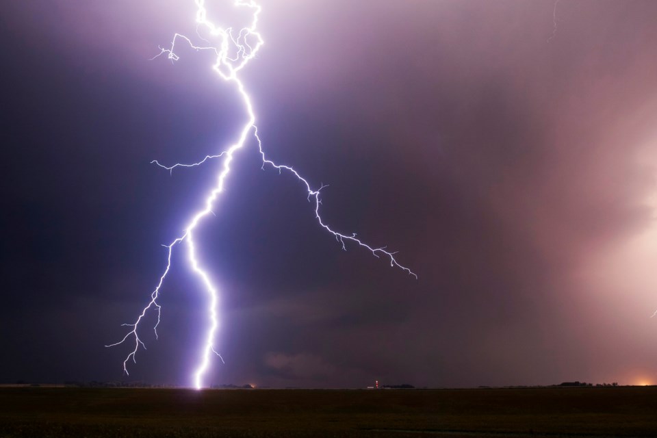
The spectacular storm that lit up the sky late Thursday as it rolled through Prince George from the southwest produced hundreds of lightning bolts and ear-splitting thunder cracks that set off car alarms and kept people awake.
The storm came in two waves, one at about 11 p.m. and one just after midnight. The second was much more intense and longer lasting and it did bring much needed rain to the region, but not nearly enough to douse the wildfires that continue to burn in the central Interior.
BC Wildfire Service Prince George Fire Centre information officer Sharon Nickel said it was still too early to determine how many new fires the lightning caused but fire officials are expecting that will be the case.
“Right now we’re kind of in a wait-and-see,” said Nickel. “We did receive about six millimetres of rain with the storms that came through and we’ll likely see holdovers (fires) that will pop up this afternoon and into the coming days.”
Holdover fires caused by lightning strikes smolder undetected on ground moistened by the rain and can burst into flame once the forest fuel in the immediate vicinity of the strike dries.
If you spot a fire, call the BC Wildfire Service immediately at 1-800-663-5555 or dial on your cell phone *5555.
Last night’s storm brought the only significant rainfall the city has had since June 29, when about 6.5 mm fell, and there’s only even trace amounts falling on any other day during the past month, which has dropped river flows substantially and raised drought concerns.
It left puddles along city streets but the rain failed to clear out the lingering wildfire smoke that continues to hang over the city. That smoke is coming from fires in the Vanderhoof-Fort St. James area as well as northwest of Mackenzie.
Light smoke conditions (less than 10 parts per million of fine particulate matter) are in the forecast for the next two days but the animated map on website firesmoke.ca shows conditions could worsen at and creep into the moderate range of 28-60 ppm.
Environment Canada has issued a severe thunderstorm watch for this afternoon and Saturday and there’s a 60 per cent chance we will see some lightning activity.
“Unfortunately it’s almost like a rinse-and-repeat type scenario for yesterday, today and tomorrow where we do see the concern for strong thunderstorm to occur over the central and northeastern part of the province,” said Environment Canada meteorologist Ken Dosanjh.
“We’re looking at gusts somewhere in the order of 70 kilometres per hour, large hail as well as heavy downpours of 20-30 millimetres per hour.
Dosanjh said the overnight storm produced between 30 and 50 lightning strikes every five minutes and wind gusts reached 78 km/hr at Prince George Airport.
Thursday’s high of 31.9 C for July 20 was a few degrees shy of the record 34.4 C set in 1931.
Today’s high is expected to hit 24 C, with an overnight low of 10 C.
Saturday will bring a mix of sun and cloud and a high of 23 C, with a 60 per cent chance of showers of thundershowers in the afternoon. No rain is in the forecast for Sunday, with a predicted high of 21 C.
A low pressure system off the north coast will continue to bring more seasonal conditions and pulses of precipitation later next week, with highs of 18 C in store for Monday and Tuesday under cloudy skies.


